Showing posts with label Roadtrips USA. Show all posts

Saturday, 16 July 2011

Days 103, 104 & 105: Roadtrip from Western Oregon to Medford

This is probably the most fun I've ever had on a roadtrip. I can't recommend Route 20 between Bend, OR and Yellowstone Park enough, especially for foreign tourists who aren't used to empty American spaces and long straight roads. Nowhere in Europe can you find a single lane road that's this driveable and empty through such wide open country. Just ignore the little bit of interstate near Boise.

 Thursday 14:51, We've already come from Talent to Crater Lake where we had the fun of seeing snow as well as the lake itself.

 Thursday 15:18, The roads are amazingly straight open, and free of other road users.  On this very stretch of road, about 18 years ago, Mike let me drive his Mum's automatic car, even though I did not have a driving license (shhhh....)

 Thursday 18:40, Still open road as we head across Eastern Oregon, but now there are no trees.  I don't know when we've ever made such good time on a roadtrip before.

 Thursday/Friday night, Our campsite is in a pretty meadow on the outside of Hines and Burns which is the only real civilization for miles and miles.   The campground has a wholesome feel but the counter in the office is covered with Bible verses and the chap who assigned us a place turned out to be from the East Coast near where Mike's dad lives.  He moved out here so he "could stay out of jail", which begs the question: are there fewer opportunities to do things that get you jailed out here or just fewer opportunities to get caught.
 Friday 10:15, We're just entering the Malheur River gorge, which didn't at first sight seem to deserve its name.

 Friday 12:31, Around the town of Vale population densities reach something like European levels and the farmland looks equally dense and prosperous.  We went to the one supermarket in town, and found that they sell saddles in the parking lot.  Since Mike and Antonia decided to picnic in the van, I crossed the parking lot, discovered that the grass lining the car park was made of plastic, crossed a little road into a sort of small picnic area and read the exhibit about the Oregon Trail. I found out that the poor devils on the Oregon Trail really did think that the Malheur river deserved its name, perhaps with good reason.  It's actually quite impressive what the area has become.
Friday 14:18, We're on the Interstate for just a little while around Boise.

 Friday 15:41, Back on route 20 again, and enjoying more big roads.  We pushed on to Craters of the Moon National Monument and made our first camp dinner under rainy skies.

 Saturday 11:44, Since for once in our lives we're ahead of schedule, we had time to spend the morning visiting Craters of the Moon.  I'll hopefully do a post about volcanic tourism later.

 Saturday 14:17, Arco has a strangely decorated mountain. We don't know why.

 Saturday 18:10, This is some kind of ancient nuclear power station in the middle of nowhere in Idaho, that Mike wanted to visit..

Saturday 20:07, we're nearly in Yellowstone and back in tree country.  We didn't realise quite how tired we were till we arrived and discovered that we were pretty confused about both the date and time, and incapable or responding coherently to people.

Friday, 8 July 2011

Days 96 and 97: Roadtrip from San Francisco to Oregon

OK, I have some advice.  If you would like to drive from San Francisco to, say, Medford, in Oregon, using the Coastal Highway, allow a good two days.  We didn't, so we basically ended up doing most of it in one day, and this is not the best idea.  See below....

 12:54 pm: Mike had to catch up on some work so we left about noon.  Antonia and I are fascinated by these little houses they have all along 19th avenue in San Francisco.  They are like mews with a garage underneath and a flat on top.

 1:07 pm: We crossed the Golden Gate Bridge under some of that shredded floating fog that San Francisco is famous for.

 2:39 pm: This is Muir Woods, a National Monument to the Coastal Redwood tree.  We got lost looking for it, so by the time we got there I had reached the stage where I had protected myself from disappointment by convincing myself that it didn't matter whether I was looking at redwoods or a parking lot.  I felt better after a walk and some lunch, but it was crowded here and hard to park (beautiful, though).

 4:51 pm: This is near the start of Route 1, the Pacific Coastal Highway.  It's very attractive and gratuitously winding.  On road like this, we plan to drive nearly 200 miles, plus another 200 miles on slightly faster road.  The fog is already rolling in, as it does on the Pacific Coast as soon as the sun is no longer powerful enough to burn it off.

 7:15 am: Next morning, it is still foggy and we've just left our campsite in Bodega Bay, where we camped in the fog, to the accompaniement of a foghorn blaring once every 47.5 seconds.  Bodega Bay is about 60 miles north of San Francisco.  We really ought to be in Eureka by now.

 9:23 am: Once the fog has lifted, Route 1 is certainly beautiful. We are starting to look for a beach to stop and eat breakfast on.

 10:45 am:  The only way to really get on the beach here is at the state beaches and parks.  This is the first one we found that was right on the road.  Mike spent the time chatting with some Californians who were testing out their antique campervan.  Antonia is drawing seagulls and making careful notes about their behaviour.  I was guzzling down coffee.

 1:21 pm: This is what grocery stores look like out here near the junction of Route 1 and 101. They sell everything: hunting licenses, live bait, 15 kinds of beef jerky, and, since this is California, relatively healthy lunch food.  It was high time we stopped.  I am not used to driving an automatic car on these windy, hilly roads, and the brakes were starting to smoke.  I think I averaged 35 mph, by the way - and nobody was passing me!

 1:50 pm: This is 101, which is a whole lot easier to drive on than 1, and also very pretty. I am trying to nap in the back of the van, Antonia is in charge of photography and Mike is driving.

 2:02 pm:  Mike told Antonia to photograph some redwoods.  I like all the bits of car that appear in her roadtrip photos because she is so small.

6:57 pm: This photo looks about the way we feel, but it does have one redeeming feature:  it says 'Welcome to Oregon' on it!


8:21 pm: That's Mount McLoughlin over there in the distance, and more importantly, that's Interstate 5, down in the bottom of the frame.  Boy, were we glad to see I 5.  If it was possible to stop in the middle of an interstate, there would be a picture here of me, Mike, and Antonia kissing I 5. We are ten minutes from our destination and as soon as I arrived I was on the 'net trying to figure out how to drive from here to Yellowstone using only interstates.  I expect I will feel more adventurous in a day or two.

Saturday, 25 June 2011

Day 85: Roadtrip from Joshua Tree to Yosemite

Wow, we have internet at Yosemite!  That means I get to post my experiment in roadtrip blogging.  I just snap away as we're driving along, then pick out one picture for about every hour and a half.  It's a lot of fun, though if I had Photoshop, I could make the colors look more normal.  The van windows fade them out a bit.

 8:50 am - Crazy sign as we leave Joshua Tree for the crazy sign fans.

 9:07 am - The 247 swoops down like a roller coaster between Yucca Valley and Landers.  We love this bit.

 10:22 am - Somehow, this doesn't seem like the road to Yosemite.  This is the road to Deep Creek Hot Springs where Mike has decided to take a detour.  He's worried because his Internet friend was supposed to get back from here last week, and hasn't been heard of on the Internet.  He wants to ask random people at the ranch and car park if they know anything about his friend.  He wants us to fee grateful he doesn't spend 4 hours hiking in to the springs and back.  Predictably, at the end of an hour and a half, we still don't know any more about the friend than we did at the start.  This is the sort of behavior that has earned Mike the nickname Force of Chaos.  So 3.5 hours into our roadtrip, we have clocked up 41 miles towards Yosemite.

 11:43 am - We are still in the Mojave Desert, trying to get out of the built up areas around Apple Valley.

 13:22 pm - We're back on the 58 where we should be, and no longer in the desert but in the golden hills of California.  They're covered in golden grass (surprise) and scattered with trees.  They look just like African savannah.  This is a very beautiful part of the road.

 13:49 pm - After Bakersfield, the 99 takes us through California's Central Valley.  It may be a good place to grow food but it's as flat as a pancake and as boring as possible.  Actually, it looks a lot like the part of the south of France I grew up in, but with fewer redeeming features.

 16:08 pm - Just outside Fresno, somebody decided to brighten the environment.  If you're going to be patriotic, you might as well go the whole the hog and paint your barn.  None of this wishy-washy buying a cheap flag at Wallmarts.

 16:36 pm - We made it to the hills behind a 1950s car that couldn't pass a fuel emissions test if it tried.

17:17pm - It's amazing how much the landscape has changed with one day's driving.

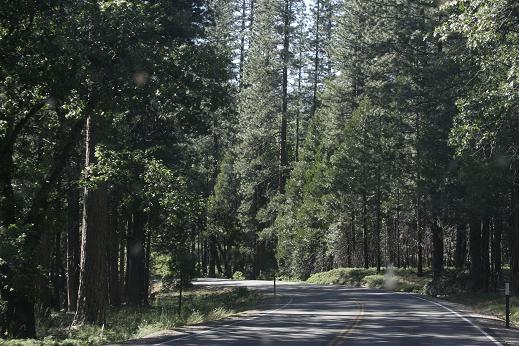
 17:20 pm - We've arrived!  I am so glad to be here that it's only a little bit galling to think that if we hadn't made that detour to Deep Creek we would have arrived before the Visitor Center closed!  BTW, as soon as Mike got on the Internet, he found an email from his friend.